

Address Finder Settings
The address finder attributes are configured using the Address Finder Settings screen.
The following options are available:
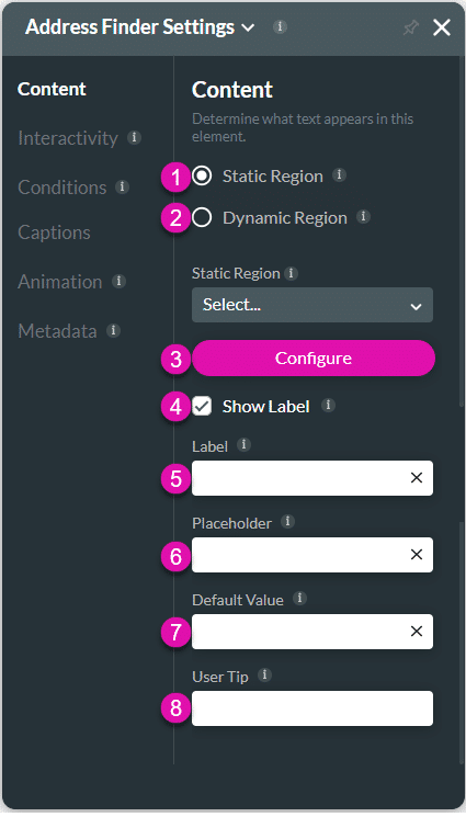
Content
Determine what text appears in this element.
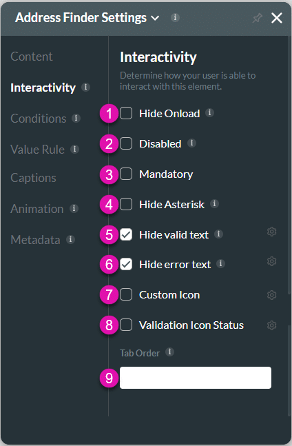
Interactivity
Determine what text appears in this element.
Conditions
Configure Conditions – Determine how your user is able to interact with this element.
Value Rule
Set Value Rules – Set conditions on how this element behaves or appears.
Captions
Captions – Customize your captions. Be sure to keep the meaning the same.
Animation
Animation – Determine animation for the element to appear.
Metadata
Metadata – See how this field is identified in the backend. Your users won’t see this.
Hidden Title
Was this information helpful?
Let us know so we can improve!
Need more help?
Book Demo